Methods
The impact of the spread of invasive species will be assessed by comparing key ecological processes that determine the climate change mitigation potential of saltmarshes between “invaded” areas and “control”, applying a multidisciplinary approach that includes experimentation, spectral signatures measurements and remote sensing and mathematical modelling. The methodology is spread in 11 different tasks to address the five specific goals of the projects.
TASKS TO ADDRESS GOAL 1:
Task 1.1. Estimation of OC deposits in aboveground biomass in control and invaded areas. This task is addressed to estimate the variability in OC deposits in aboveground biomass of invaded and native communities at a yearly scale.
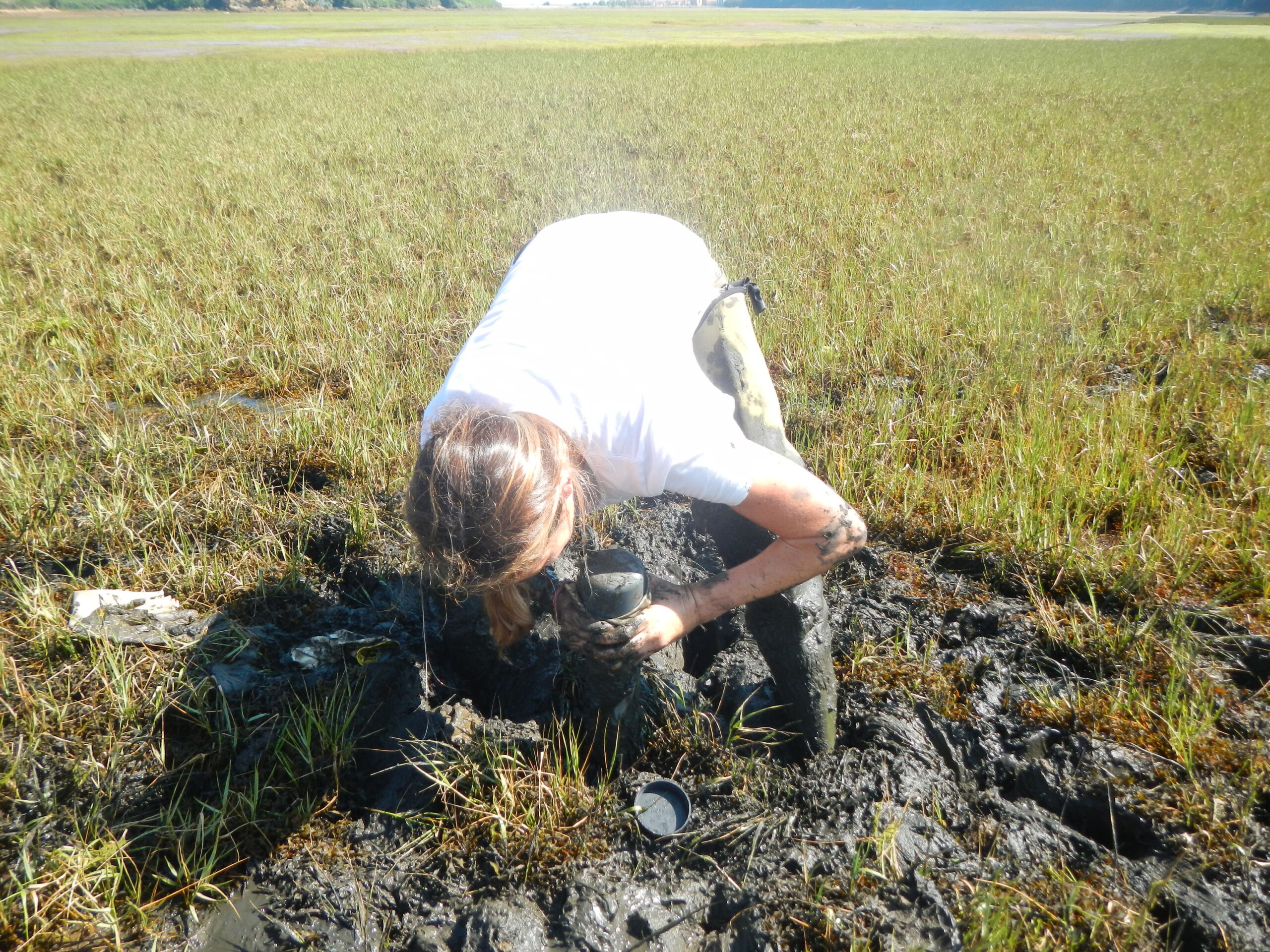
Task 1.2. Assessment of OC sedimentation rates in native and invaded saltmarsh communities In this task, sedimentation rates will be measured in control and invaded areas at each study site by applying the sediment traps technique.
Task 1.3. Characterization of soil OC deposits in native and invaded communities. This task will estimate the magnitude of soil OC deposits and the burial rates and characterize the main sources of OC and the relative stability of soil OC deposits in control and invaded communities.
TASKS TO ADDRESS GOAL 2:
Task 2.1. Estimation of GHG emissions from invaded and native communities. This task aims to assess the impact of invasive species in greenhouse gases (GHG) fluxes from saltmarsh soils. GHG (CH4, CO2) fluxes from sediment will be assessed through the static chamber technique.
TASKS TO ADDRESS GOAL 3:
Task 3.1. Creation of ground-truth datasets. This task will generate a ground-truth dataset of native (i.e. Juncus maritimus, Spartina maritima) and invasive species (i.e. Baccharis halimifolia, Spartina alterniflora) occurrences to train and validate remote sensing-based distribution algorithms.
Task 3.2. Analysis of the spectral phenology derived from hyperspectral data. This task will identify the spectral patterns intrinsically associated to both native (i.e. Juncus maritimus, Spartina maritima) and invasive species (i.e. Baccharis halimifolia, Spartina alterniflora), paramount to determine the spectral regions and temporal frames in which the discretization of these species is optimal.
Task 3.3. Remote sensing-based techniques for mapping native and invasive species. The distribution of native (i.e. Juncus maritimus, Spartina maritima) and invasive species (i.e. Baccharis halimifolia, Spartina alterniflora) at the study sites will be estimated using high spatial resolution images from airborne (PNOA flights and drones) and/or satellite remote sensors (i.e. Sentinel-2 constellations).
Task 3.4. Quality assessment of remote sensing-based mapping. Remote sensing-based maps will be validated using ground-truth data.
Task 3.5. Identification of the spatial and temporal trends in the distribution of native and invasive species applying the mapping methodology developed in Task 3.3 and validated in
TASKS TO ADDRESS GOAL 4:
Task 4.1. Development of predictive models of organic carbon stocks in aboveground biomass. This task will develop algorithms to systematically assess, quantify and monitor changes in the OC stored in saltmarsh biomass. The algorithms will be developed based on the OC stocks in aboveground biomass measured in Task 1.1 and different indexes of biophysical vegetation properties (e.g. LAI, NDVI, fPAR etc.) calculated from remote sensing images processed during each of the fieldwork campaigns (Task 1.3).
Task 4.2. Assessment of the spatial and temporal variability that the spread of invasive species has caused in the OC stored in biomass by native species. The predictive models developed (Task 4.1) will be applied to historical images (from 1985 to 2024) that show changes in the relative distribution and area occupied by native and invasive species.
TASKS TO ADDRESS GOAL 5:
Task 5.1. Knowledge transfer and dissemination. This project will implement different actions to maximize the social, scientific and policy impact of the project, including presentation of results to local and national authorities with competences on Conservation, Biodiversity and Climate Change mitigation, publication of scientific papers in open access journals, presentation of results in international conferences and publication of data generated in global databases. The results of the project will be included in the Web viewer managed by IHCantabria to host and show the mapping of littoral ecosystems created with remote sensing (https://nano.ihcantabria.com/resultados/visor-nanozoostera/). In addition, the knowledge generated within the project will be disseminated to the general public through international scientific outreach events.


